


Voting District 0054676000002, Allegan County, Michigan
About
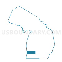
Outline

Summary
| Unique Area Identifier | 595790 |
| Name | Voting District 0054676000002 |
| County | Allegan County |
| State | Michigan |
| Area (square miles) | 11.64 |
| Land Area (square miles) | 11.09 |
| Water Area (square miles) | 0.55 |
| % of Land Area | 95.27 |
| % of Water Area | 4.73 |
| Latitude of the Internal Point | 42.73640790 |
| Longtitude of the Internal Point | -85.56980600 |
Maps


Graphs
Select a template below for downloading or customizing gragh for Voting District 0054676000002, Allegan County, Michigan


Neighbors
Neighoring Voting District (by Name) Neighboring Voting District on the Map
- Voting District 0054676000001, Allegan County, MI
- Voting District 0058490000001, Allegan County, MI
- Voting District 0157962000001, Barry County, MI
- Voting District 0158902000001, Barry County, MI
- Voting District 0811250000001, Kent County, MI
- Voting District 0813124000001, Kent County, MI
- Voting District 0813124000007, Kent County, MI
Top 10 Neighboring County Subdivision (by Population) Neighboring County Subdivision on the Map
- Gaines charter township, Kent County, MI (25,146)
- Caledonia township, Kent County, MI (12,332)
- Thornapple township, Barry County, MI (7,884)
- Leighton township, Allegan County, MI (4,934)
- Yankee Springs township, Barry County, MI (4,065)
- Wayland township, Allegan County, MI (3,088)
Top 10 Neighboring Unified School District (by Population) Neighboring Unified School District on the Map
- Caledonia Community Schools, MI (21,389)
- Wayland Union Schools, MI (17,580)
- Thornapple Kellogg School District, MI (15,303)
Top 10 Neighboring State Legislative District Lower Chamber (by Population) Neighboring State Legislative District Lower Chamber on the Map
- State House District 72, MI (103,319)
- State House District 88, MI (99,795)
- State House District 87, MI (96,428)
Top 10 Neighboring State Legislative District Upper Chamber (by Population) Neighboring State Legislative District Upper Chamber on the Map
Top 10 Neighboring 111th Congressional District (by Population) Neighboring 111th Congressional District on the Map
Top 10 Neighboring Census Tract (by Population) Neighboring Census Tract on the Map
- Census Tract 103, Barry County, MI (7,884)
- Census Tract 305, Allegan County, MI (7,281)
- Census Tract 148.07, Kent County, MI (6,964)
- Census Tract 304.02, Allegan County, MI (4,820)
- Census Tract 104.02, Barry County, MI (4,065)
- Census Tract 148.03, Kent County, MI (3,057)